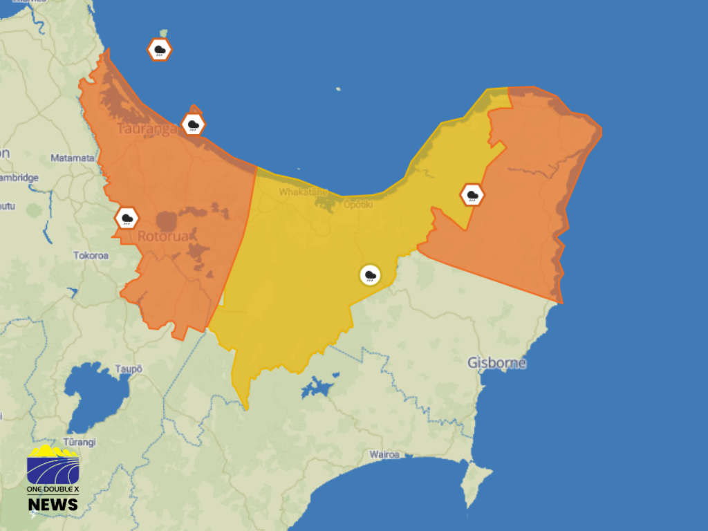
The Bay of Plenty west of Kawerau is under an orange heavy rain warning until 3.00pm today.
MetService said the region can expect 60 to 80 mm of rain on top of what has already fallen, with peak rates of 10 to 20 mm/h.
It said localised downpours could reach rates of 25 mm/h.
"Further rain is possible from late this afternoon into early Friday morning."
There is a "minimal chance" of upgrading to a red warning.
A heavy rain watch is also in place for the rest of the region, about and east of Kawerau, from 2.00pm today until 9.00am Friday, 14 August.
Periods of heavy rain may approach warning criteria and localised downpours are possible.
MetService said there is a "moderate chance" of upgrading to a warning.
The forcaster said a warm and humid airmass is moving across the country, stalled by a low pressure system from the Tasman Sea.
It said this means northeastern parts of the North Island will see persistent rain, potentially through into Sunday.
Meteorologist Ethan Walton-Jones said these rainfall amounts bring the risk of rising rivers and streams, surface flooding, slips and dangerous driving conditions.
"Avoid low-lying areas and drive to the conditions.”
NZTA said drivers should be ready for weather related hazards, such as localised flooding, slips, rockfalls, and slippery roads.
"Drivers should increase their following distance, reduce speed, avoid sudden braking, and use headlights if visibility is poor," the transport agency said.
Contractors are monitoring the transport network for any issues that may arise.
 Police Crack Down on New Gang Chapters in Ōpōtiki
 Under the House to the Try Line: Ruby and Her 11 Pups Seek Forever Homes
 Eastern Bay Local Government Future Left in Limbo After Head Start Decision Delayed
 Hillcrest Road Closures Scheduled for Friday