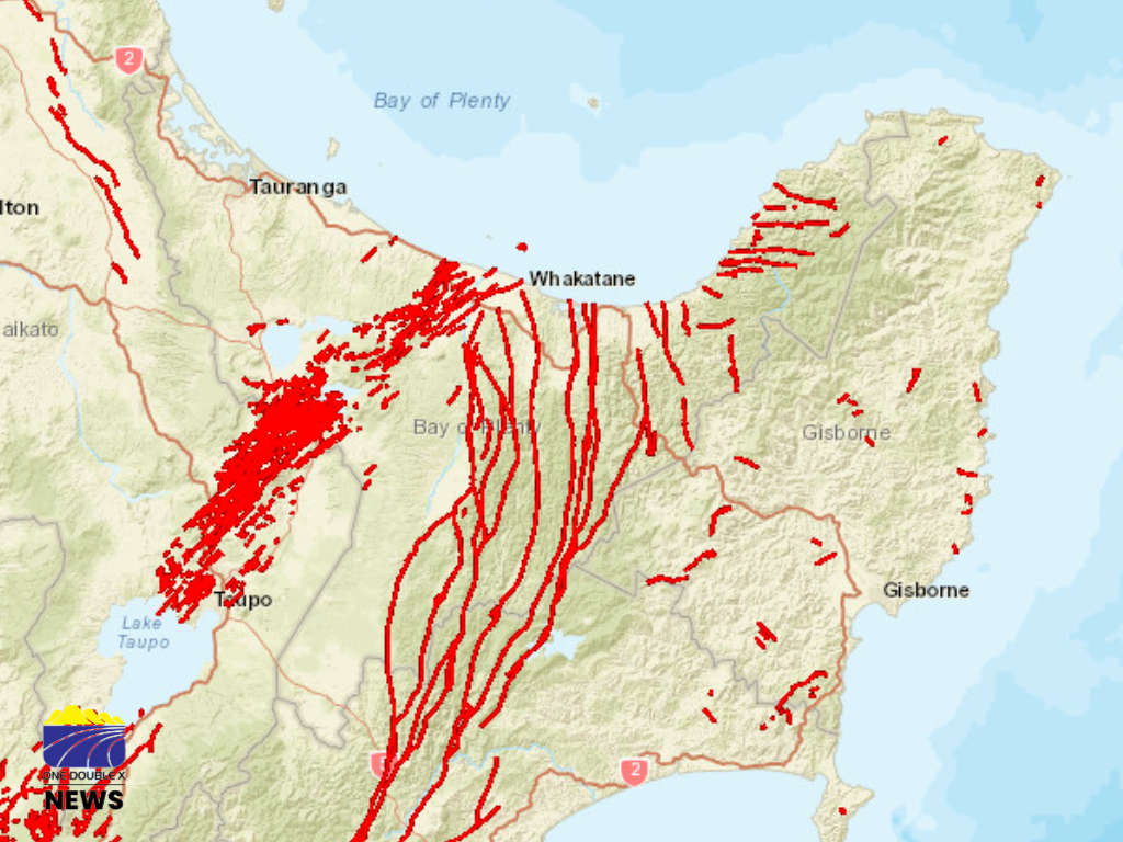
Scientists will begin mapping earthquake faults beneath Whakatāne District as part of a new project aimed at improving understanding of natural hazards.
The district sits within a unique geological setting spanning both the Taupō Volcanic Zone and the North Island fault system, making it prone to natural hazards such as earthquakes and landslides.
Active fault mapping will identify areas where the ground has previously moved and where future movement could occur.
Active faults in the district are already recorded in the New Zealand Active Fault Database, but some of the information is not detailed enough to support local planning and decision-making.
Whakatāne District Council said the project aims to fill that gap.
Earth Sciences New Zealand will carry out the project with co-funding support from Bay of Plenty Regional Council.
District Council Manager Policy Planning and Consents Nicholas Woodley said the project is about the quality of the information the Council holds.
"Active faults are a natural part of our landscape and understanding them is part of understanding the place we live,” he said.
“This project is about making sure the information we have is as detailed as it can be."
As part of the project, Earth Sciences New Zealand will review existing fault information, carry out detailed mapping using aerial photos and laser scanning of the land surface (LiDAR), and produce updated fault maps, digital mapping data and technical reports.
Scientists may also carry out on-the-ground verification at selected locations.
“Where access to private land is required, landowners will be contacted directly and permission sought before any visit takes place,” said the Council.
The information will be used in the council's day-to-day work, including assessing resource and building consents and preparing Land Information Memoranda (LIMs).
It will also support long-term natural hazards planning, emergency management and infrastructure planning.
"Better data means a clearer picture of the district's natural environment, and that benefits everyone who lives, builds and invests here," Woodley said.
Mapping, field verification and technical reporting will continue until December 2026.
 Te Tāhuhu o Te Rangi Invites Local Residents to Celebrate Te Wiki o te Reo Māori
 Body Located During Search for Missing Man
 SH2 Near Te Puke Golf Course to Close This Weekend for Railway Crossing Repairs
 Volunteers Aid Search for Missing Ōpōtiki Man