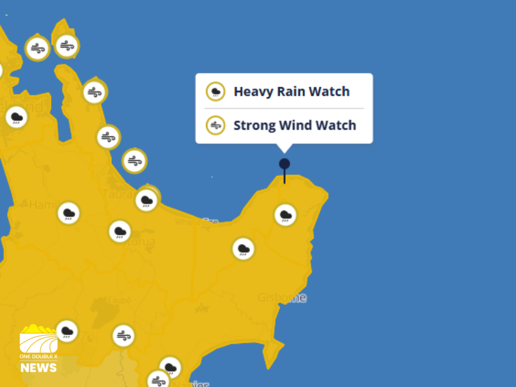
A heavy rain watch remains in place for the Bay of Plenty, about and east of Whakatāne, until 4pm Thursday, April 9.
MetService said the region can expect period of heavy rain with amounts that may approach warning criteria.
“Low chance of upgrading to a warning,” it said.
"Further heavy rain (associated with Cyclone Vaianu) is possible on Sunday and a new Watch may be issued for this area closer to the time."
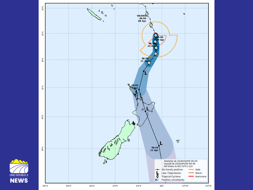
The latest forecast track map issued by Tropical Cyclone Warning Centre. IMAGE // MetService
Another heavy rain watch is in place for the Bay of Plenty, west of Whakatāne on Sunday, April 12 from 2am to 4pm.
"Periods of heavy rain, and amounts may approach or exceed warning criteria," said MetService
"Large swells and coastal inundation are likely. High chance of upgrading to a Warning."
A strong wind watch has also been issued for Te Ika-a-Māui, North Island, from 4am on Sunday to 1am on Monday.
MetService said easterly quarter winds turn southwesterly to the west, some are likely to reasch severe gale in exposed places.
It said uncertainty remains over the cyclone's exact track, so the location of the most severe wind remains unknown.
“As confidence in the track increases, parts of this Watch will be upgraded to Orange or possibly Red Warnings,” said MetService.
“Vaianu will also bring heavy rain, with Heavy Rain Watches and/or Warnings likely to be issued on Thursday for some areas. High chance of upgrading to a Warning.”
Whakatāne District Council are urging residents to prepare early as Cyclone Vaianu nears.
The council are closely monitoring the storm, set to begin impacting parts of Aotearoa New Zealand from early Sunday morning.
Council said emergency response planning has been activated, "with the Council working alongside MetService New Zealand and partner agencies to track the system and prepare for potential impacts."
Local controller Nicholas Woodley says there is uncertainty around the cyclone's exact path; however, the message to prepare now remains clear.
“This is a system we are taking very seriously,” said Woodley.
“While we can’t yet say exactly what impacts we will see locally, there is enough uncertainty and potential risk - particularly around coastal surge and heavy rainfall - that people should be preparing now rather than waiting.”
Council are already responding to the effects of the last system of heavy rain, "including surface flooding, downed trees and localised road issues."
"With ground conditions saturated, the risk of slips and landslides is heightened, especially in steep or vulnerable areas," it said.
Woodley said now is the time to prepare because "we know how quickly weather impacts can escalate in this district.”
“Preparing early - securing loose items, planning for possible power outages, and thinking about what you would do if access became limited - helps avoid rushed decisions later.”
No evacuations are required yet, but Woodley said the council are encouraging residents, particularly in coastal areas, or those who feel unsafe, to make early arrangements to stay with friends and whānau.
“Cyclone conditions are currently forecast to arrive around 3am Sunday. No one wants to be evacuating in the dark, in severe weather,” he said.
“If you have concerns about your safety, the safest option is to move early - ideally before Saturday night - and stay with friends or whānau.”
If evacuations become necessary, they will be led by the police, with affected properties door-knocked directly.
Council urges people to stay well clear of beaches, river mouths and coastal areas, "where conditions can become unpredictable very quickly."
A Welfare Centre will be activated at the Whakatāne War Memorial Hall and potentially at other locations if required.
Residents who notice flooding, slips, fallen trees or road damage should report them to the council.
Urgent issues can be reported to the council's 24/7 call centre on 07 306 0500, and no urgent issues should be logged using the Fix It and Report a Problem form on the council's website.
“Our priority is keeping our communities safe and well-informed. Prepared beats panicked. This is about being ready, not being alarmed,” said Woodley.
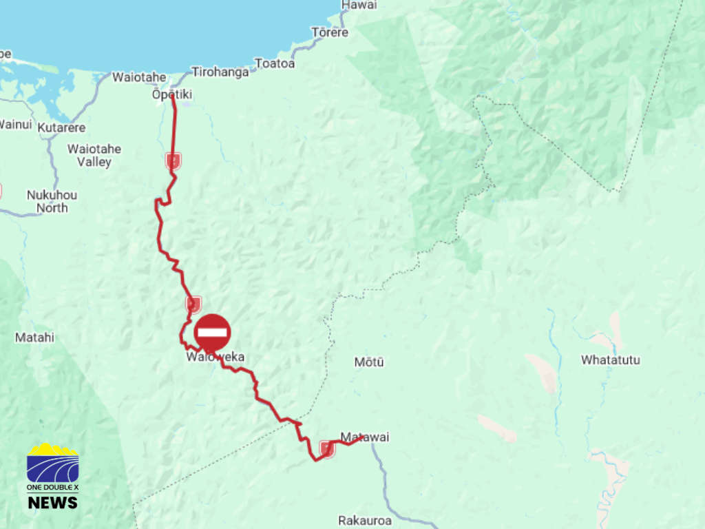
State Highway 2 through the Waioweka Gorge is closed. IMAGE // NZTA
NZTA said the Waioweka Gorge will remain closed for the remainder of the day.
It said following a slip overnight, the risk has been reassessed and they have decided to prioritise the safety of their crews and motorists.
"People are urged to delay travel where possible or allow at least 3 hours of extra time for a long detour either via State Highway 35 or State Highway 5," it said.
Crews are continuing to clear debris, however material is still coming down the slip face.
Residents and emergency services will be allowed through the closure for essential access and response, particularly ahead of the incoming Cyclone Vaianu, it said.
It urges road users to take extra care in the region due to surface flooding in other areas around the Eastern Bay of Plenty.
The road was closed this morning and reopened for a period of time this morning.
Whakatāne District Council is reporting several hazards caused by the wet weather.
It said crews are on their way to Tahuna Road, where a fallen tree is blocking one lane.
The community is urged to avoid 58 The Strand outside the former Framer shop, and 28 Muriwai Drive near Wairaka Centennial Playground due to surface flooding.
“The Peace Street ford is working as it should - moving surface water away from houses and over the road into the sponge reserve stormwater drainage area,” said the council.
“Please avoid Peace Street if you can due to the surface flooding over the ford area.”
Herepuru Rd, at the State Highway 2 end, has been closed since 8:00pm on Tuesday until further notice.
Flooding has been reported on Te Kooti and Burnett Roads.
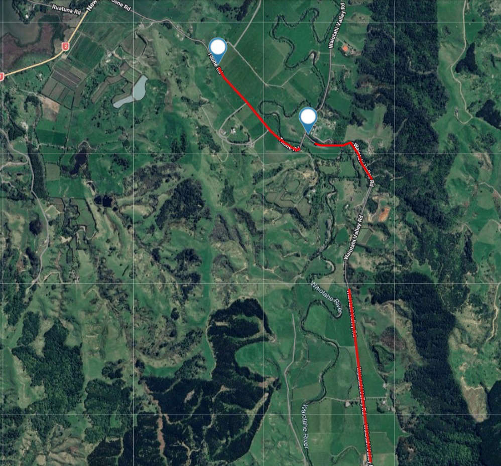
Road closures on Toone and Waiotahi Roads
Ōpōtiki District Council said two locations marked above on Toone and Waiotahi Valley Road are closed.
It said after heavy rain, the Waiotahe River has flooded areas of both roads.
It said people needing to access the north end of Toone Road can access it via State Highway 2.
Rain is now easing in the area, and Council staff will assess the road in the morning.
Hato Hone St John was notified of a crash on Ōhope Road at 12:32 today.
One ambulance, one operations manager and one rapid response vehicle responded to the incident.
It said one patient was assessed and treated at the scene by the ambulance crew but did not require transportation to hospital.
Police said they were notified of the crash, on Cliff Road, where the vehicle had gone off the road.
A boil notice is in place for Rūātoki residents.
The council said the recent heavy rain means the Rūātoki Water Treatment Plant isn’t working properly.
“The water is dirty and cloudy (high turbidity), which means the UV system may not be removing all the bugs from the water.”
Residents should boil water for at least 3 minutes before using it for drinking, cooking, brushing teeth, or preparing food.
“If you're using an electric jug, you may need to boil it twice to reach 3 minutes,” said the council.
“This notice is a precaution and will stay in place until the water is confirmed safe to drink.”
Council is testing daily.
Bay of Plenty Regional Council senior maritime officer for the eastern region Dan Bramley said the Whakatāne river is expected to peak "just below the boats out warning level later today."
"Be aware there is debris in the river and more likely to come down over the next few days," said Bramley.
The Harbourmaster, Flood and Emergency Management Teams are monitoring the situation.
The Ministry of Primary Industries are advising communities to include animals in emergency planning.
Pets should be easy to identify with things such as ID tags and microchips, in case you get separated from them.
For livestock, MPI said large animals such as horses should have a tag added to their halter, lead or cover and be microchipped.
"Ensure your National Animal Identification and Tracing (NAIT) programme details are up-to-date."
It said you should ensure you have emergency kits for both yourself and animals, including things like first aid kits, food and water.
 Search Teams Located Body in Search for Missing Diver in Whakatāne.
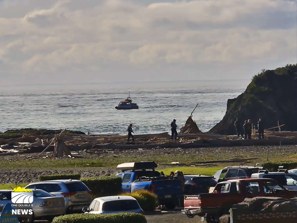 Emergency Services Searching for Missing Diver
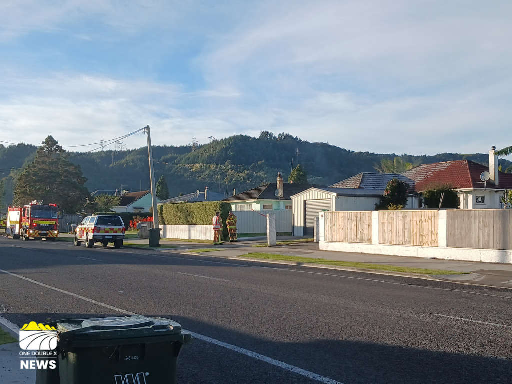 Newly Adopted Dog Credited With Saving Man in Whakatāne Blaze
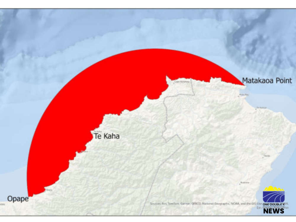 East Cape Shellfish Biotoxin Alerts Lifted